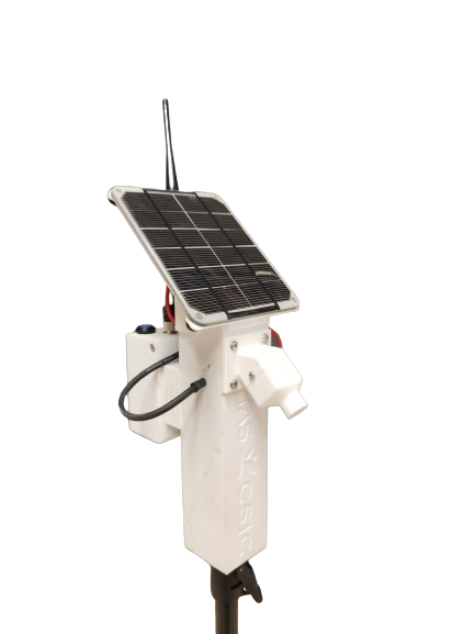
PyRADTEMCam
Radiometric calibration system for thermal infrared cameras mounted on UAVs. Combines IoT sensor nodes with LoRaWAN communication, calibration panels, and a Python correction model — reducing temperature error from 6°C to <0.5°C.
Check it out →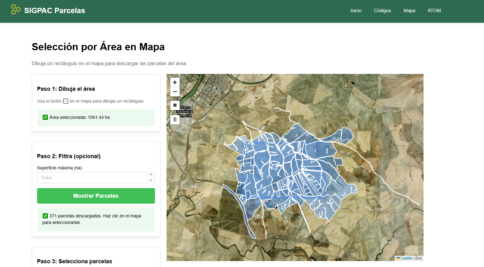
SIGPAC Parcelas
A web application for downloading SIGPAC agricultural plot vectors across Spain. Supports selection by individual parcel codes, interactive map drawing, and advanced filters (area, slope, land use). Exports directly to GeoPackage and Shapefile formats.
Check it out →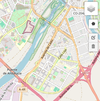
Nostalgic Visualizator
A web visualizer for historical imagery in Spain, allowing users to select a region of interest and explore archival aerial photography from different decades. An accessible tool for studying landscape evolution and historical land-use changes.
Check it out →
Python Courses for Agriculture
Specialized Python courses designed for agricultural professionals and researchers, covering data analysis, thermal and multispectral image processing, and geospatial analysis. Delivered to both private companies and public institutions.
Available on request